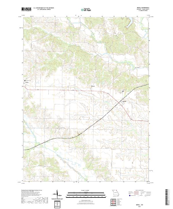
2021 Map of Medill
USGS Topo · Published 2021About this map
Medill and the surrounding rural landscape of Clark County are defined by a complex network of waterways that have shaped local settlement and agriculture for generations. The Wyaconda River cuts across the southern portion of the map, revealing the Old Channel North Wyaconda River where the stream once naturally meandered. To the north, the Little Fox River and Fox River create a well-watered corridor for the communities of Luray and Ashton. Local history is anchored by sites like the Zimmerman Cem and Medill Cem, providing vital reference points for genealogical research in this part of Missouri. The map illustrates a rural transport system including State Hwy AA and Drew Bridge, which connects dispersed farmsteads to these small township hubs. The drainage patterns of Linn Creek and Honey Cr further illustrate the topographic character of the region as it transitioned into the twenty-first century.
Find a feature on this map
22 named features on this map. Tap any name to fly to it.
Don’t see what you’re looking for? This feature index may not catch every label — zoom into the map to look around manually.
Map Details
Editions of this 2021 Medill Map
This is the sole edition of this map. No revisions or reprints were ever made.
Other maps of this area

1903 · Kahoka
USGS Topo · 1:125,000

1949 · Kahoka
USGS Topo · 1:24,000

1949 · St. Patrick
USGS Topo · 1:24,000

1950 · Kahoka
USGS Topo · 1:24,000

1950 · Saint Patrick
USGS Topo · 1:24,000

1950 · Neeper
USGS Topo · 1:24,000

1950 · Medill
USGS Topo · 1:24,000

1950 · Colony
USGS Topo · 1:24,000

1951 · Colony
USGS Topo · 1:24,000

1951 · Neeper
USGS Topo · 1:24,000