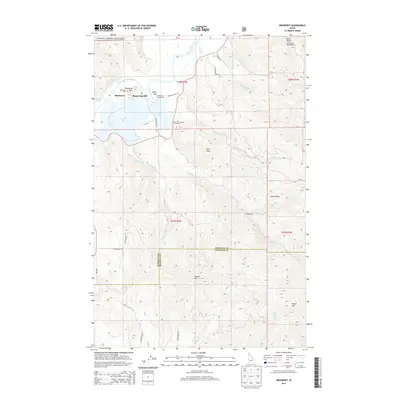
2014 Map of Medimont
USGS Topo · Published 2014About this map
Medimont and its surrounding wetlands define the landscape where the Coeur d'Alene River meanders toward a series of lateral lakes. This area of Kootenai County is characterized by the complex hydrology of Medicine Lake, Cave Lake, and Swan Lake, which sit at the base of prominent peaks like Medicine Mtn and Smaq'wqn-Hill. The northern portion of the map is dominated by the Coeur d'Alene Nat For, showing a transition from the river valley to the high ridges of the panhandle. Local history is anchored by the Medimont Cem and recreation at the Rainy Hill Campground. Further south, the terrain becomes increasingly vertical, climbing toward Petit Peak, Grassy Mtn, and Round Top as it crosses the Kootenai Co Benewah Co line. The map captures a network of forest and county roads, such as Rainy Hills Rd and Brackling's Bay Rd, that provide access to this isolated lake-and-mountain geography.
Find a feature on this map
43 named features on this map. Tap any name to fly to it.
Don’t see what you’re looking for? This feature index may not catch every label — zoom into the map to look around manually.
Map Details
Editions of this 2014 Medimont Map
This is the sole edition of this map. No revisions or reprints were ever made.
Other maps of this area

1903 · Rathdrum
USGS Topo · 1:125,000

1909 · Cataldo
USGS Topo · 1:125,000

1911 · Cataldo
USGS Topo · 1:125,000

1950 · Rochat Peak
USGS Topo · 1:24,000

1952 · Rochat Peak
USGS Topo · 1:24,000

1955 · Spokane
USGS Topo · 1:250,000

1957 · St. Maries
USGS Topo · 1:62,500

1957 · Kingston
USGS Topo · 1:62,500

1957 · Lane
USGS Topo · 1:62,500

1957 · St. Joe
USGS Topo · 1:62,500