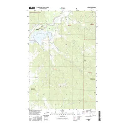
2017 Map of Medimont
USGS Topo · Published 2017About this map
The Coeur d'Alene River winds through this landscape, feeding a complex chain of water bodies including Swan Lake, Cave Lake, and Medicine Lake. The settlement of Medimont serves as the primary hub of human activity, situated near the Medimont Cem at the base of Medicine Mtn. This area in Kootenai County is defined by the transition from the river valley wetlands to the high peaks of the Coeur d'Alene National Forest.
Find a feature on this map
47 named features on this map. Tap any name to fly to it.
Don’t see what you’re looking for? This feature index may not catch every label — zoom into the map to look around manually.
Map Details
Editions of this 2017 Medimont Map
This is the sole edition of this map. No revisions or reprints were ever made.
Other maps of this area

1903 · Rathdrum
USGS Topo · 1:125,000

1909 · Cataldo
USGS Topo · 1:125,000

1911 · Cataldo
USGS Topo · 1:125,000

1950 · Rochat Peak
USGS Topo · 1:24,000

1952 · Rochat Peak
USGS Topo · 1:24,000

1955 · Spokane
USGS Topo · 1:250,000

1957 · St. Maries
USGS Topo · 1:62,500

1957 · Kingston
USGS Topo · 1:62,500

1957 · Lane
USGS Topo · 1:62,500

1957 · St. Joe
USGS Topo · 1:62,500