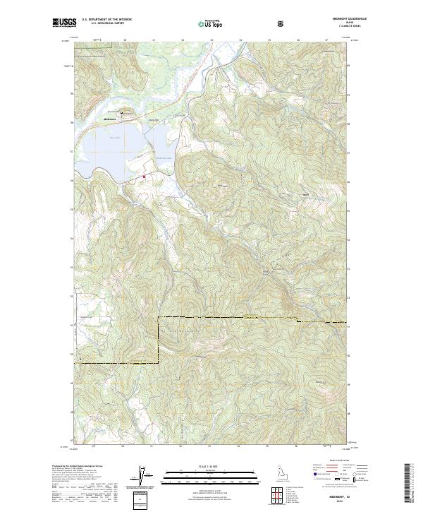
2024 Map of Medimont
USGS Topo · Published 2024About this map
Medimont serves as the focal point for this landscape along the Coeur d'Alene River, where the waterway feeds into a complex of wetlands and large basins including Cave Lake and Medicine Lake. The settlement is closely tied to its surroundings, with the Medimont Cem and a network of logging and forest access roads like S Robinson Creek Rd and S Medimont Rd extending into the steep slopes of the Coeur d'Alene National Forest. This modern record of the Idaho Panhandle captures the topographical transition from the river valley to the heights of the St. Joe Mountains and Grassy Mtn. A significant recreational and historical artery, the Trail of the Coeur d'Alene's Trl, follows the northern bank of the river, tracing the route of former industrial transport through this mountain corridor.
Find a feature on this map
49 named features on this map. Tap any name to fly to it.
Don’t see what you’re looking for? This feature index may not catch every label — zoom into the map to look around manually.
Map Details
Editions of this 2024 Medimont Map
This is the sole edition of this map. No revisions or reprints were ever made.
Other maps of this area

1903 · Rathdrum
USGS Topo · 1:125,000

1909 · Cataldo
USGS Topo · 1:125,000

1911 · Cataldo
USGS Topo · 1:125,000

1950 · Rochat Peak
USGS Topo · 1:24,000

1952 · Rochat Peak
USGS Topo · 1:24,000

1955 · Spokane
USGS Topo · 1:250,000

1957 · St. Maries
USGS Topo · 1:62,500

1957 · Kingston
USGS Topo · 1:62,500

1957 · Lane
USGS Topo · 1:62,500

1957 · St. Joe
USGS Topo · 1:62,500