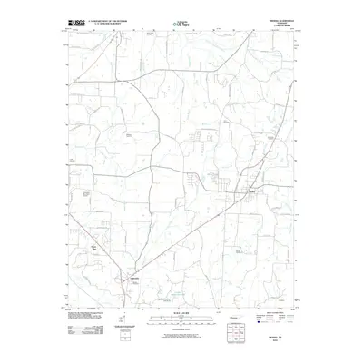
2010 Map of Medina
USGS Topo · Published 2010About this map
Medina and Gibson anchor the central and northern reaches of this West Tennessee landscape, where the agricultural grid is defined by the winding paths of Turkey Creek and the North Fork Forked Deer River. The region’s rural heritage is preserved through a high concentration of family and community burial grounds, including White Rose Cemetery, Williams Cemetery, and Pruitt Cemetery. In the south, the settlement of Three Way and the Fairview area show the transition toward more developed corridors, supported by the presence of Humboldt Municipal Airport. The map also captures local recreational and utility landmarks such as Camp Williamson Lake and its accompanying Camp Williamson Lake Dam, illustrating the importance of water management in this creek-veined territory.
Find a feature on this map
78 named features on this map. Tap any name to fly to it.
Don’t see what you’re looking for? This feature index may not catch every label — zoom into the map to look around manually.
Map Details
Editions of this 2010 Medina Map
This is the sole edition of this map. No revisions or reprints were ever made.
Other maps of this area

1950 · Jackson North
USGS Topo · 1:24,000

1951 · Jackson North
USGS Topo · 1:24,000

1951 · Trenton
USGS Topo · 1:24,000

1952 · Milan
USGS Topo · 1:24,000

1953 · Claybrook
USGS Topo · 1:24,000

1956 · Blytheville
USGS Topo · 1:250,000

1959 · Medina
USGS Topo · 1:24,000

1959 · Blytheville
USGS Topo · 1:250,000

1959 · Adair
USGS Topo · 1:24,000

1959 · Humboldt
USGS Topo · 1:24,000