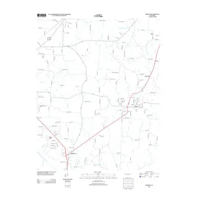
2013 Map of Medina
USGS Topo · Published 2013About this map
Medina serves as the primary hub in this West Tennessee landscape, situated along a prominent north-south transit corridor that connects it to neighboring communities like West and Goat City. The terrain is defined by the complex drainage of the Forked Deer River system, including the N Fork Forked Deer River and its associated lowlands at Dawson Bottom. To the south, the community of Three Way and the Fairview area mark a point of increasing suburban density.
Find a feature on this map
138 named features on this map. Tap any name to fly to it.
Don’t see what you’re looking for? This feature index may not catch every label — zoom into the map to look around manually.
Map Details
Editions of this 2013 Medina Map
This is the sole edition of this map. No revisions or reprints were ever made.
Other maps of this area

1950 · Jackson North
USGS Topo · 1:24,000

1951 · Jackson North
USGS Topo · 1:24,000

1951 · Trenton
USGS Topo · 1:24,000

1952 · Milan
USGS Topo · 1:24,000

1953 · Claybrook
USGS Topo · 1:24,000

1956 · Blytheville
USGS Topo · 1:250,000

1959 · Medina
USGS Topo · 1:24,000

1959 · Blytheville
USGS Topo · 1:250,000

1959 · Adair
USGS Topo · 1:24,000

1959 · Humboldt
USGS Topo · 1:24,000