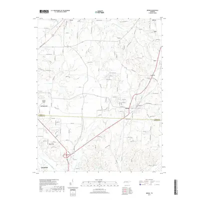
2019 Map of Medina
USGS Topo · Published 2019About this map
Medina and the northern outskirts of Jackson define this landscape along the border of Gibson and Madison Counties. This West Tennessee corridor shows a transition from the agricultural lands surrounding Gibson and Sitka to the more developed intersections at Three Way and Fairview. The river systems, including the N Fork Forked Deer River and Middle Fork Forked Deer River, dictate the drainage patterns that shaped the early settlement of the region. Family names and local history are preserved in the numerous cemeteries scattered across the terrain, such as White Rose Cem, Mariah Cem, and the Williams Cem. Notable local landmarks like the Humboldt Municipal Airport and Camp Williamson Lake reflect the mix of mid-century infrastructure and rural recreation that characterizes the area between Humboldt and Milan.
Find a feature on this map
131 named features on this map. Tap any name to fly to it.
Don’t see what you’re looking for? This feature index may not catch every label — zoom into the map to look around manually.
Map Details
Editions of this 2019 Medina Map
This is the sole edition of this map. No revisions or reprints were ever made.
Other maps of this area

1950 · Jackson North
USGS Topo · 1:24,000

1951 · Jackson North
USGS Topo · 1:24,000

1951 · Trenton
USGS Topo · 1:24,000

1952 · Milan
USGS Topo · 1:24,000

1953 · Claybrook
USGS Topo · 1:24,000

1956 · Blytheville
USGS Topo · 1:250,000

1959 · Medina
USGS Topo · 1:24,000

1959 · Blytheville
USGS Topo · 1:250,000

1959 · Adair
USGS Topo · 1:24,000

1959 · Humboldt
USGS Topo · 1:24,000