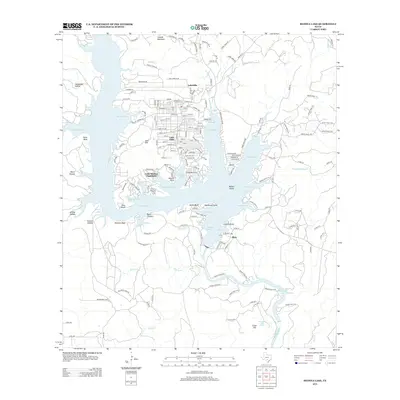
2013 Map of Medina Lake
USGS Topo · Published 2013About this map
Medina Lake dominates this landscape, its irregular shoreline creating a complex network of residential enclaves and recreational coves. The community of Lakehills and its subdivision Lake Hills form the primary population center on the northern peninsula, defined by a dense grid of local streets like Center St and Park RD-37. To the south, the village of Mico sits near the Diversion Dam, where the Medina River continues southward into Diversion Lake.
Find a feature on this map
193 named features on this map. Tap any name to fly to it.
Don’t see what you’re looking for? This feature index may not catch every label — zoom into the map to look around manually.
Map Details
Editions of this 2013 Medina Lake Map
This is the sole edition of this map. No revisions or reprints were ever made.
Other maps of this area

1954 · San Antonio
USGS Topo · 1:250,000

1956 · New Fountain
USGS Topo · 1:62,500

1956 · Bandera
USGS Topo · 1:62,500

1956 · Medina Lake
USGS Topo · 1:62,500

1957 · San Antonio
USGS Topo · 1:250,000

1958 · La Coste NE
USGS Topo · 1:24,000

1964 · Riomedina
USGS Topo · 1:24,000

1964 · Bandera
USGS Topo · 1:24,000

1964 · Timber Creek
USGS Topo · 1:24,000

1964 · Medina Lake
USGS Topo · 1:24,000