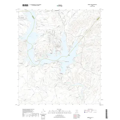
2019 Map of Medina Lake
USGS Topo · Published 2019About this map
Lakehills sits at the heart of this landscape, serving as a primary settlement along the northern reaches of Medina Lake. The shoreline is characterized by a complex network of inlets and coves, including Spettel Cove, Plum Creek Cove, and Angel Cove, which reflect the area's development around the reservoir's variable water levels. Significant topography rises from the water's edge, marked by features such as Liebold Mtn, Turks Head, and Mormon Bluff. Transport routes like FM 1283 and State Hwy Park Rd 37 connect the residential developments of Hamilton and Cousins Point to the broader region across the Bandera and Medina county line. Downstream, the presence of Diversion Dam Springs and Cedar Hill suggests the transition from the lake's recreational focus to the managed water systems of the Texas Hill Country.
Find a feature on this map
155 named features on this map. Tap any name to fly to it.
Don’t see what you’re looking for? This feature index may not catch every label — zoom into the map to look around manually.
Map Details
Editions of this 2019 Medina Lake Map
This is the sole edition of this map. No revisions or reprints were ever made.
Other maps of this area

1954 · San Antonio
USGS Topo · 1:250,000

1956 · New Fountain
USGS Topo · 1:62,500

1956 · Bandera
USGS Topo · 1:62,500

1956 · Medina Lake
USGS Topo · 1:62,500

1957 · San Antonio
USGS Topo · 1:250,000

1958 · La Coste NE
USGS Topo · 1:24,000

1964 · Riomedina
USGS Topo · 1:24,000

1964 · Bandera
USGS Topo · 1:24,000

1964 · Timber Creek
USGS Topo · 1:24,000

1964 · Medina Lake
USGS Topo · 1:24,000