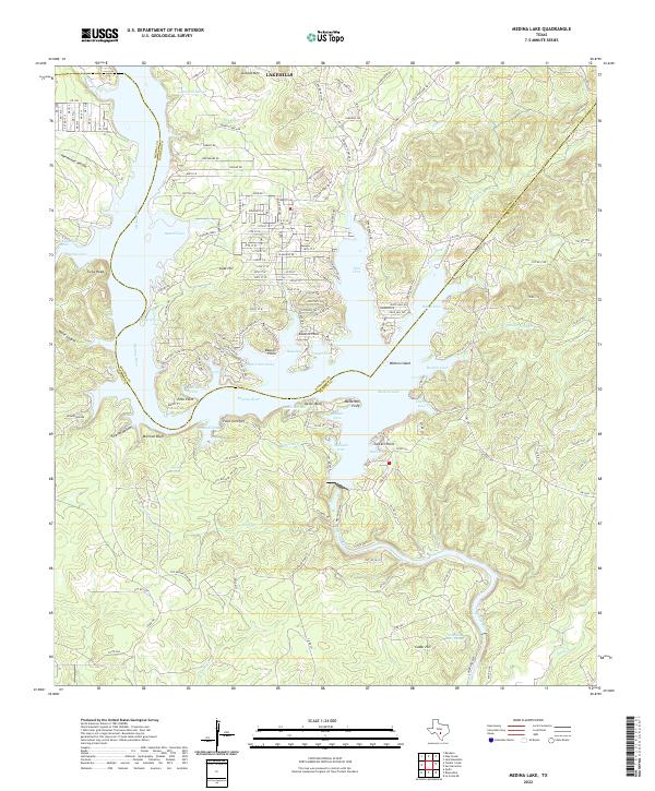
2022 Map of Medina Lake
USGS Topo · Published 2022About this map
Lakehills and the intricate shoreline of the Medina River dominate this modern survey of the reservoir and its surrounding hill country. The landscape is defined by its deep coves and named points, reflecting decades of residential development and recreational access since the original damming of the river. Features like Mormon Bluff and Sawmill Cove hint at the earlier human activities and land use that predated the high-water line of Medina Lake.
Find a feature on this map
167 named features on this map. Tap any name to fly to it.
Don’t see what you’re looking for? This feature index may not catch every label — zoom into the map to look around manually.
Map Details
Editions of this 2022 Medina Lake Map
This is the sole edition of this map. No revisions or reprints were ever made.
Other maps of this area

1954 · San Antonio
USGS Topo · 1:250,000

1956 · New Fountain
USGS Topo · 1:62,500

1956 · Bandera
USGS Topo · 1:62,500

1956 · Medina Lake
USGS Topo · 1:62,500

1957 · San Antonio
USGS Topo · 1:250,000

1958 · La Coste NE
USGS Topo · 1:24,000

1964 · Riomedina
USGS Topo · 1:24,000

1964 · Bandera
USGS Topo · 1:24,000

1964 · Timber Creek
USGS Topo · 1:24,000

1964 · Medina Lake
USGS Topo · 1:24,000