2023 Map of Medina
USGS Topo · Published 2023About this map
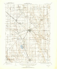
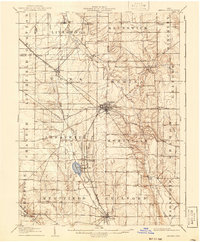
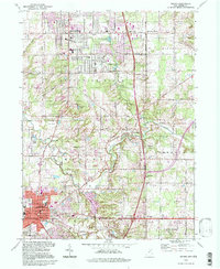
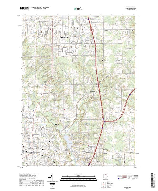
Medina serves as the focal point of this survey, where the Medina County Courthouse anchors the historic downtown district. The landscape is defined by the winding course of the West Branch Rocky River and its various tributaries, including the North Branch West Branch Rocky River which flows into Lake Medina. To the north, the growing community of Brunswick spreads across the terrain, while smaller crossroads like Weymouth and Windfall retain their local identity. Genealogists will find a high concentration of burial sites throughout the area, from the central Old Medina Cem and Spring Grove Cem to rural locations such as the Hamilton Corners Cem and Weymouth Cem. The presence of several small water bodies, including Lake Sleepy Hollow and Rustic Hills Lake, indicates the residential and recreational evolution of the county.
Find a feature on this map
43 named features on this map. Tap any name to fly to it.
Don’t see what you’re looking for? This feature index may not catch every label — zoom into the map to look around manually.
Map Details
Editions of this 2023 Medina Map
This is the sole edition of this map. No revisions or reprints were ever made.
Historical Maps of Hinckley Township Through Time
6 maps found