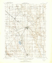
1904 Map of Medina
USGS Topo · Published 1960About this map
Medina serves as the central hub of this 1904 survey, where a radial network of railroads and wagon roads converges. The local economy and transport patterns are defined by the Northern Ohio RR and the Cleveland Lorain and Wheeling RR, which intersect at Lester to the northwest of the county seat. The rural landscape is dotted with small hamlets like Mallet Creek, Whittlesey, and Abbeyville, many established along the valleys of the West Branch Rocky River and Plum Creek.
Find a feature on this map
59 named features on this map. Tap any name to fly to it.
Don’t see what you’re looking for? This feature index may not catch every label — zoom into the map to look around manually.
Map Details
Editions of this 1904 Medina Map
2 editions found

Other maps of this area

1901 · Oberlin
USGS Topo · 1:62,500

1901 · Massillon
USGS Topo · 1:62,500

1901 · Wooster
USGS Topo · 1:62,500

1902 · Berea
USGS Topo · 1:62,500

1903 · Massillon
USGS Topo · 1:62,500

1903 · Wooster
USGS Topo · 1:62,500

1903 · Cleveland
USGS Topo · 1:62,500

1903 · Oberlin
USGS Topo · 1:62,500

1903 · Akron
USGS Topo · 1:62,500

1904 · Berea
USGS Topo · 1:62,500