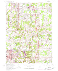
1963 Map of Medina
USGS Topo · Published 1974About this map
The West Branch Rocky River meanders through this landscape, which in the early 1960s was transitioning from a rural township structure into a more suburban pattern centered around Medina and Brunswick. The southern portion of the sheet is dominated by the county seat of Medina, showing the concentrated civic center with its Courthouse, City Hall, and several schools including Garfield Sch and St Xavier Sch. Further north, Brunswick and Brunswick Hills exhibit significant development with the appearance of a large Shopping Center and residential expansion near Lake Brunswick and Sleepy Hollow Lake. Local history is captured in traditional landmarks like Maple Grove Cem and the Pythian Sisters Home. The Baltimore and Ohio railroad corridor and the interstate highway network reflect the era's focus on connectivity, even as smaller hamlets like Weymouth and Sherman Corners maintain their historic footprint.
Find a feature on this map
52 named features on this map. Tap any name to fly to it.
Don’t see what you’re looking for? This feature index may not catch every label — zoom into the map to look around manually.
Map Details
Editions of this 1963 Medina Map
2 editions found
Other maps of this area

1902 · Berea
USGS Topo · 1:62,500

1903 · Cleveland
USGS Topo · 1:62,500

1903 · Akron
USGS Topo · 1:62,500

1904 · Berea
USGS Topo · 1:62,500

1904 · Medina
USGS Topo · 1:62,500

1905 · Akron
USGS Topo · 1:62,500

1906 · Medina
USGS Topo · 1:62,500

1950 · Cleveland
USGS Topo · 1:250,000

1953 · West View
USGS Topo · 1:24,000

1953 · Broadview Heights
USGS Topo · 1:24,000