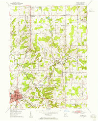
1953 Map of Medina
USGS Topo · Published 1955About this map
Medina serves as the focal point of this mid-century survey, centered around the Courthouse and a grid of streets including Bronson St and Smith Road. The settlement landscape is dense with educational and religious markers of the era, from High School and Garfield School to St Xavier School. Beyond the city limits, the terrain is defined by the winding paths of the West Branch Rocky River and North Branch Rocky River, which converge near the village of Weymouth.
Find a feature on this map
48 named features on this map. Tap any name to fly to it.
Don’t see what you’re looking for? This feature index may not catch every label — zoom into the map to look around manually.
Map Details
Editions of this 1953 Medina Map
This is the sole edition of this map. No revisions or reprints were ever made.
Other maps of this area

1902 · Berea
USGS Topo · 1:62,500

1903 · Cleveland
USGS Topo · 1:62,500

1903 · Akron
USGS Topo · 1:62,500

1904 · Berea
USGS Topo · 1:62,500

1904 · Medina
USGS Topo · 1:62,500

1905 · Akron
USGS Topo · 1:62,500

1906 · Medina
USGS Topo · 1:62,500

1950 · Cleveland
USGS Topo · 1:250,000

1953 · West View
USGS Topo · 1:24,000

1953 · Broadview Heights
USGS Topo · 1:24,000