2020 Map of Medina SW
USGS Topo · Published 2020About this map
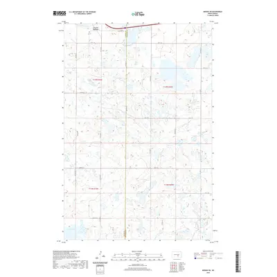
Crystal Springs sits at the northern edge of this North Dakota landscape, situated along the path of Interstate 94. This prairie region, divided by the Kidder Co Stutsman Co border, is defined by an intricate network of wetlands and small water bodies that dot the township lines of t139n r70w, t139n r69w, t138n r70w, and t138n r69w. The land reflects a strict section-line grid of rural roads, including 46th Ave SE and 38th St SE, which navigate the depressions of the glaciated terrain. To the south, Lake George dominates the lower corner, while the evocatively named Stink Lake lies to the northeast. The presence of the Crystal Springs Cem near the town site provides a primary point of interest for genealogists tracing early families in this section of the Great Plains.
Find a feature on this map
23 named features on this map. Tap any name to fly to it.
Don’t see what you’re looking for? This feature index may not catch every label — zoom into the map to look around manually.
Map Details
Editions of this 2020 Medina SW Map
This is the sole edition of this map. No revisions or reprints were ever made.
Other maps of this area

1952 · Tappen SE
USGS Topo · 1:24,000

1952 · Tappen NE
USGS Topo · 1:24,000

1953 · Jamestown
USGS Topo · 1:250,000

1954 · Medina
USGS Topo · 1:24,000

1955 · Crystal Springs
USGS Topo · 1:24,000

1955 · Medina SW
USGS Topo · 1:24,000

1955 · Medina SE
USGS Topo · 1:24,000

1956 · Jamestown
USGS Topo · 1:250,000

1975 · Medina SW
USGS Topo · 1:24,000

1983 · Streeter
USGS Topo · 1:24,000