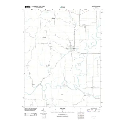
2010 Map of Medora
USGS Topo · Published 2010About this map
The East Fork White River and Muscatatuck River define the southern and eastern reaches of this landscape, carving through a series of named hollows and ridges. This 2010 topographic record highlights the complex local geography where Steward Hollow, Carr Hollow, and Wheeler Hollow meet the river bottoms. The settlement of Medora sits as a central hub, surrounded by smaller communities such as Sparksville and Weddeville.
Find a feature on this map
59 named features on this map. Tap any name to fly to it.
Don’t see what you’re looking for? This feature index may not catch every label — zoom into the map to look around manually.
Map Details
Editions of this 2010 Medora Map
This is the sole edition of this map. No revisions or reprints were ever made.
Other maps of this area

1934 · Bedford
USGS Topo · 1:48,000

1937 · Bedford
USGS Topo · 1:62,500

1951 · Smedley
USGS Topo · 1:24,000

1953 · Kossuth
USGS Topo · 1:24,000

1956 · Vincennes
USGS Topo · 1:250,000

1957 · Vincennes
USGS Topo · 1:250,000

1957 · Campbellsburg
USGS Topo · 1:24,000

1958 · Vincennes
USGS Topo · 1:250,000
1958 · Norman
USGS Topo · 1:24,000

1958 · Brownstown
USGS Topo · 1:24,000