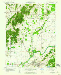
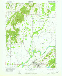
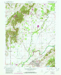
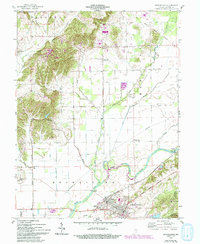
1958 Map of Brownstown
USGS Topo · Published 1960About this map
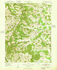
Brownstown and the adjacent community of Ewing anchor this mid-century portrait of Jackson County, where industrial activity and agricultural drainage define the landscape. The Baltimore and Ohio railroad corridor passes through the southern towns, supporting local industry evidenced by the Brick Kilns, Clay Pit, and Quarry near the East Fork White River. Further north, the Chicago Milwaukee St Paul and Pacific line connects smaller settlements like Surprise and Acme.
Find a feature on this map
48 named features on this map. Tap any name to fly to it.
Don’t see what you’re looking for? This feature index may not catch every label — zoom into the map to look around manually.
Map Details
Editions of this 1958 Brownstown Map
4 editions found
Other maps of this area

1942 · Franklin
USGS Topo · 1:125,000

1942 · Columbus
USGS Topo · 1:125,000
1948 · Waymansville
USGS Topo · 1:24,000

1953 · Cincinnati
USGS Topo · 1:250,000

1953 · Indianapolis
USGS Topo · 1:250,000

1956 · Indianapolis
USGS Topo · 1:250,000
1956 · Story
USGS Topo · 1:24,000

1956 · Vincennes
USGS Topo · 1:250,000

1956 · Louisville
USGS Topo · 1:250,000

1957 · Indianapolis
USGS Topo · 1:250,000