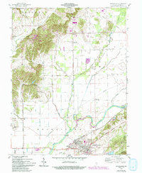
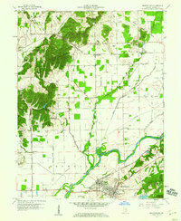
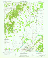
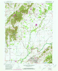
1958 Map of Brownstown
USGS Topo · Published 1994About this map
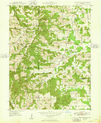
The Old Indian Treaty Boundary slices diagonally across the landscape of central Jackson County, a reminder of the region's early frontier history. This mid-century survey centers on Brownstown and Ewing, where the Baltimore and Ohio railroad corridor supports local industry, including Brick Kilns, a Quarry, and a Clay Pit. To the west, the topography rises sharply into the Hoosier National Forest, characterized by numerous rural churches like Hill Top Ch and Pleasant Grove Ch. The White River and its many tributaries, including Salt Creek and Spray Creek, dominate the lowlands. Notable local landmarks like the Shields Covered Bridge and another Covered Bridge near Ewing provide specific points of interest for those tracing the county's engineering and transportation heritage.
Find a feature on this map
43 named features on this map. Tap any name to fly to it.
Don’t see what you’re looking for? This feature index may not catch every label — zoom into the map to look around manually.
Map Details
Editions of this 1958 Brownstown Map
4 editions found
Other maps of this area

1942 · Franklin
USGS Topo · 1:125,000

1942 · Columbus
USGS Topo · 1:125,000
1948 · Waymansville
USGS Topo · 1:24,000

1953 · Cincinnati
USGS Topo · 1:250,000

1953 · Indianapolis
USGS Topo · 1:250,000

1956 · Indianapolis
USGS Topo · 1:250,000
1956 · Story
USGS Topo · 1:24,000

1956 · Vincennes
USGS Topo · 1:250,000

1956 · Louisville
USGS Topo · 1:250,000

1957 · Indianapolis
USGS Topo · 1:250,000