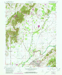
1958 Map of Brownstown
USGS Topo · Published 1981About this map
Brownstown and the neighboring community of Ewing serve as the focal point for this survey, situated along the Baltimore and Ohio Railroad. The landscape is defined by the winding course of the East Fork White River and the West Branch White River, where the Shields Covered Bridge stands as a notable landmark near the settlement of Shields. Industrial activity is evident on the outskirts of the county seat, featuring Brick Kilns, a Clay Pit, and a Quarry that speak to the region's historical extractive economy.
Find a feature on this map
47 named features on this map. Tap any name to fly to it.
Don’t see what you’re looking for? This feature index may not catch every label — zoom into the map to look around manually.
Map Details
Editions of this 1958 Brownstown Map
4 editions found

Other maps of this area

1942 · Franklin
USGS Topo · 1:125,000

1942 · Columbus
USGS Topo · 1:125,000

1948 · Waymansville
USGS Topo · 1:24,000

1953 · Cincinnati
USGS Topo · 1:250,000

1953 · Indianapolis
USGS Topo · 1:250,000

1956 · Indianapolis
USGS Topo · 1:250,000

1956 · Story
USGS Topo · 1:24,000

1956 · Vincennes
USGS Topo · 1:250,000

1956 · Louisville
USGS Topo · 1:250,000

1957 · Indianapolis
USGS Topo · 1:250,000