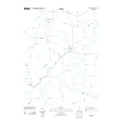
2013 Map of Medora
USGS Topo · Published 2013About this map
Medora serves as the primary hub in this southern Indiana landscape, situated at the junction of several routes near the winding E Fork White River. The terrain is defined by a series of narrow valleys and prominent elevations, such as Byarlay Knob and Fleene Ridge, with the Knobs Overlook offering a vantage point over the undulating topography. To the south, the Muscatatuck River snakes through the bottomlands, joined by several man-made drainage systems including Zollman Ditch and Stuckwisch Ditch. Small communities and family-named hollows like Pleasantville, Weddeville, and Daulton Hollow are scattered throughout the quadrangle, connected by an extensive network of county roads. The drainage patterns of Guthrie Creek and Greasy Creek illustrate the complex watershed that feeds the larger river systems, supporting the agricultural and rural character of Jackson County during this period.
Find a feature on this map
79 named features on this map. Tap any name to fly to it.
Don’t see what you’re looking for? This feature index may not catch every label — zoom into the map to look around manually.
Map Details
Editions of this 2013 Medora Map
This is the sole edition of this map. No revisions or reprints were ever made.
Other maps of this area

1934 · Bedford
USGS Topo · 1:48,000

1937 · Bedford
USGS Topo · 1:62,500

1951 · Smedley
USGS Topo · 1:24,000

1953 · Kossuth
USGS Topo · 1:24,000

1956 · Vincennes
USGS Topo · 1:250,000

1957 · Vincennes
USGS Topo · 1:250,000

1957 · Campbellsburg
USGS Topo · 1:24,000

1958 · Vincennes
USGS Topo · 1:250,000
1958 · Norman
USGS Topo · 1:24,000

1958 · Brownstown
USGS Topo · 1:24,000