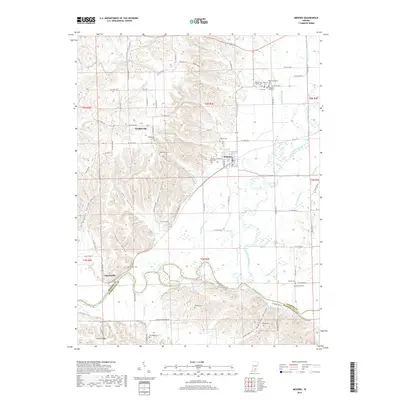
2019 Map of Medora
USGS Topo · Published 2019About this map
Medora serves as a central hub on this Indiana landscape, situated where the lowlands of the East Fork White River meet the rising elevations of the southwest. The geography is defined by a dense network of drainage ditches like Hinderlider Ditch and Zollman Ditch, reflecting a highly managed agricultural environment alongside the winding path of the Muscatatuck River. For those researching local families, the map is particularly rich in cemetery locations, ranging from Spur Cem near the town center to more isolated sites like Heighton Hill Cem and Shoemaker Cem. To the west, the terrain becomes more varied with features such as Byarlay Knob and Fleene Ridge, while the small settlements of Sparksville and Weddleville mark the transitions between the river bottoms and the wooded hollows.
Find a feature on this map
99 named features on this map. Tap any name to fly to it.
Don’t see what you’re looking for? This feature index may not catch every label — zoom into the map to look around manually.
Map Details
Editions of this 2019 Medora Map
This is the sole edition of this map. No revisions or reprints were ever made.
Other maps of this area

1934 · Bedford
USGS Topo · 1:48,000

1937 · Bedford
USGS Topo · 1:62,500

1951 · Smedley
USGS Topo · 1:24,000

1953 · Kossuth
USGS Topo · 1:24,000

1956 · Vincennes
USGS Topo · 1:250,000

1957 · Vincennes
USGS Topo · 1:250,000

1957 · Campbellsburg
USGS Topo · 1:24,000

1958 · Vincennes
USGS Topo · 1:250,000
1958 · Norman
USGS Topo · 1:24,000

1958 · Brownstown
USGS Topo · 1:24,000