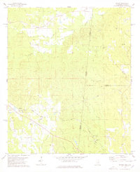
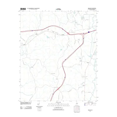
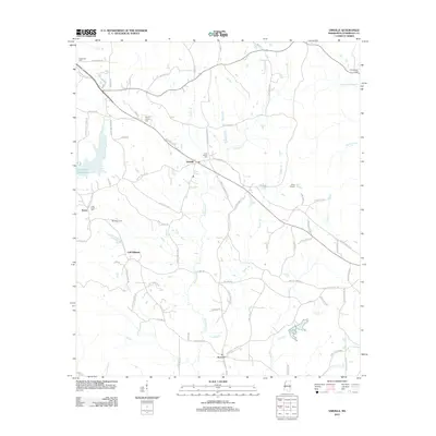
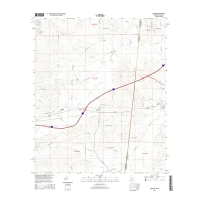
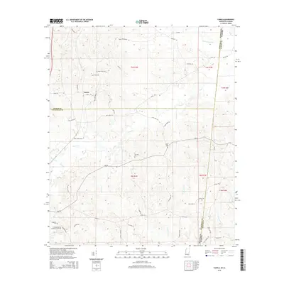
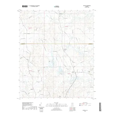
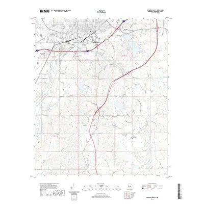
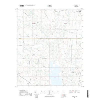
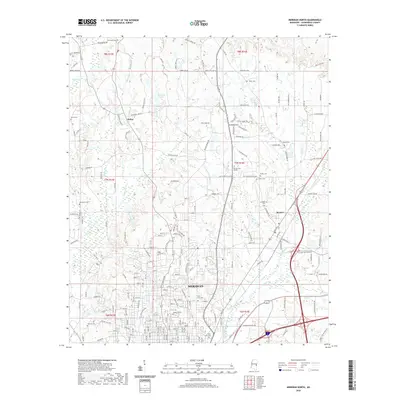
1982 Map of Meehan
USGS Topo · Published 1983About this map
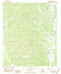
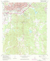
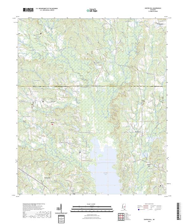
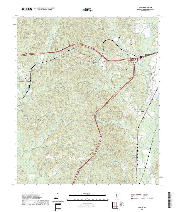
The Illinois Central Gulf railroad carves through the undulating terrain of western Lauderdale County, following a route that passes directly through a prominent tunnel near Central Hill. This corridor was essential for movement between rural settlements like Meehan and Graham, connecting the local timber and agricultural landscape to the growing infrastructure of nearby Meridian. The map captures a transitional landscape where traditional rural life, evidenced by numerous country churches such as Mt Zion Ch and Poplar Spring Ch, sits alongside modern developments like Key Field and the National Fish Hatchery.
Find a feature on this map
41 named features on this map. Tap any name to fly to it.
Don’t see what you’re looking for? This feature index may not catch every label — zoom into the map to look around manually.
Map Details
Editions of this 1982 Meehan Map
This is the sole edition of this map. No revisions or reprints were ever made.
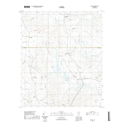
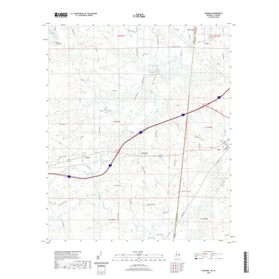
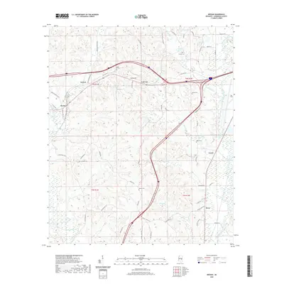
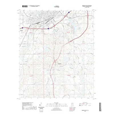
Historical Maps of Meridian Through Time
54 maps found
1962 Center Hill
Lauderdale County, MS
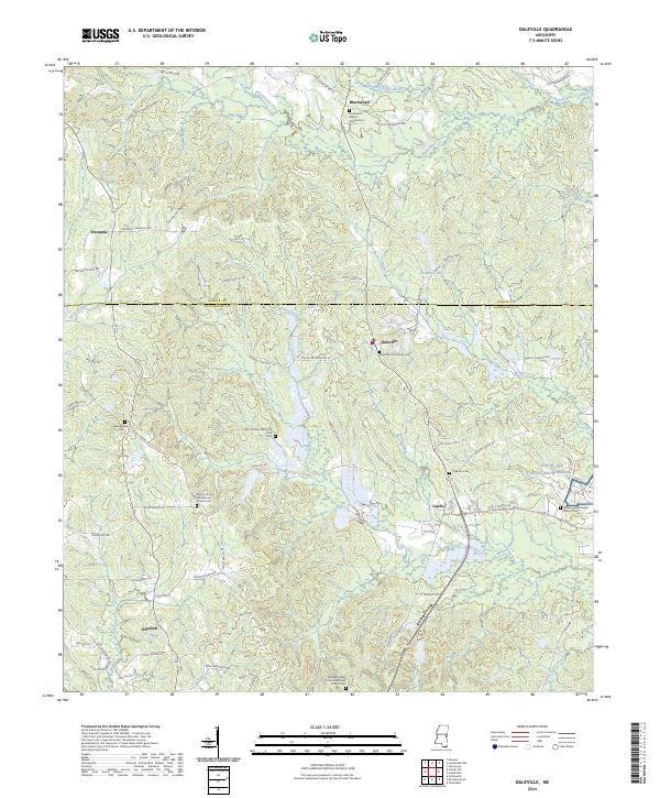
1962 Daleville
Lauderdale County, MS
1971 Meridian North
Lauderdale County, MS
1971 Meridian South
Lauderdale County, MS
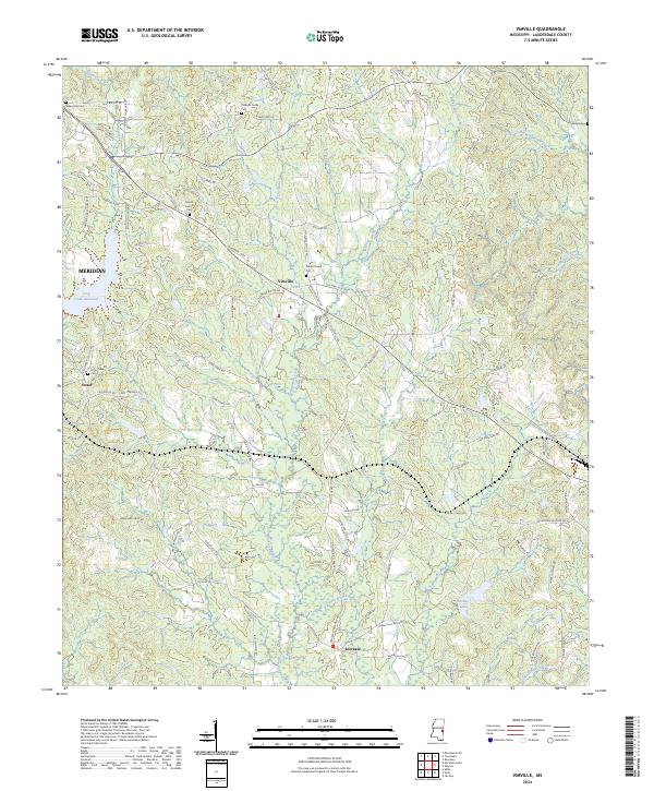
1971 Vimville
Lauderdale County, MS
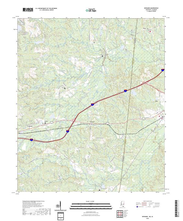
1974 Kewanee
Lauderdale County, MS
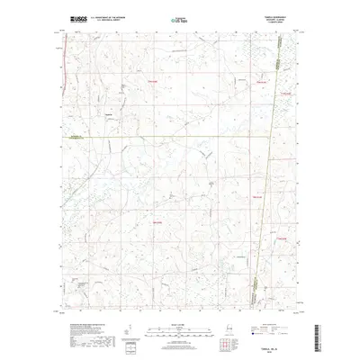
1974 Tamola
Lauderdale County, MS
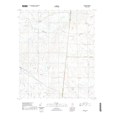
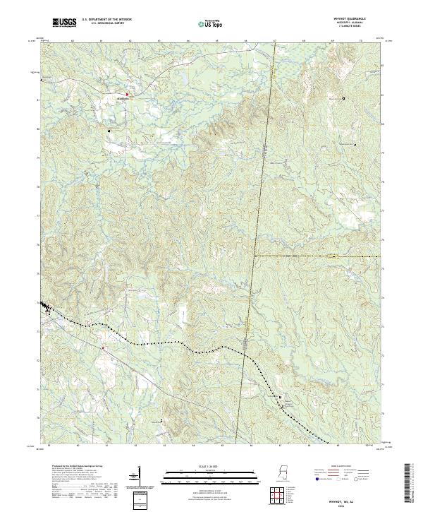
1978 Whynot
Lauderdale County, MS
1982 Meehan
Lauderdale County, MS
2012 Center Hill
Lauderdale County, MS
2012 Daleville
Lauderdale County, MS
2012 Kewanee
Lauderdale County, MS
2012 Meehan
Lauderdale County, MS
2012 Meridian North
Lauderdale County, MS
2012 Meridian South
Lauderdale County, MS
2012 Tamola
Lauderdale County, MS
2012 Vimville
Lauderdale County, MS
2012 Whynot
Lauderdale County, MS
2015 Center Hill
Lauderdale County, MS
2015 Daleville
Lauderdale County, MS
2015 Kewanee
Lauderdale County, MS
2015 Meehan
Lauderdale County, MS
2015 Meridian North
Lauderdale County, MS
2015 Meridian South
Lauderdale County, MS
2015 Tamola
Lauderdale County, MS
2015 Vimville
Lauderdale County, MS
2015 Whynot
Lauderdale County, MS
2018 Center Hill
Lauderdale County, MS
2018 Daleville
Lauderdale County, MS
2018 Kewanee
Lauderdale County, MS
2018 Meehan
Lauderdale County, MS
2018 Meridian North
Lauderdale County, MS
2018 Meridian South
Lauderdale County, MS
2018 Tamola
Lauderdale County, MS
2018 Vimville
Lauderdale County, MS
2018 Whynot
Lauderdale County, MS
2020 Center Hill
Lauderdale County, MS
2020 Daleville
Lauderdale County, MS
2020 Kewanee
Lauderdale County, MS
2020 Meehan
Lauderdale County, MS
2020 Meridian North
Lauderdale County, MS
2020 Meridian South
Lauderdale County, MS
2020 Tamola
Lauderdale County, MS
2020 Vimville
Lauderdale County, MS
2020 Whynot
Lauderdale County, MS
2024 Center Hill
Lauderdale County, MS
2024 Daleville
Lauderdale County, MS
2024 Kewanee
Lauderdale County, MS
2024 Meehan
Lauderdale County, MS
2024 Meridian North
Lauderdale County, MS
2024 Meridian South
Lauderdale County, MS
2024 Tamola
Lauderdale County, MS
2024 Vimville
Lauderdale County, MS
2024 Whynot
Lauderdale County, MS