Loading...
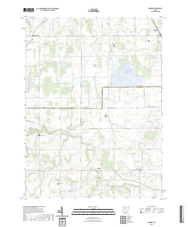
Loading map...2023 Map of Meeker
USGS Topo · Published 2023About this map
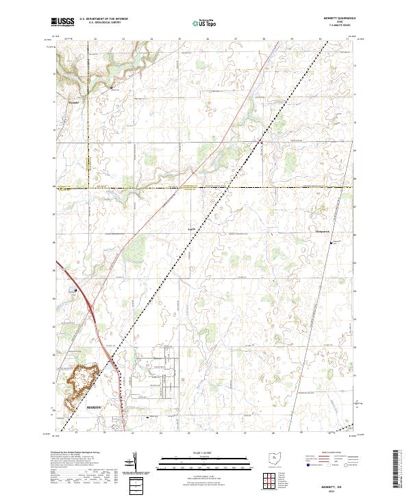
Meeker sits at the intersection of several rural routes in this section of north-central Ohio, where the drainage patterns of Tymochtee Creek and its tributaries like Blood Run and Prairie Run define the agricultural landscape. The map reveals a high density of small family or community burial grounds, such as Bowsher-ville Cem, Yoakum Cem, and Frame Cem, which provide significant points of interest for genealogists tracing local lineage.
Find a feature on this map
64 named features on this map. Tap any name to fly to it.
Don’t see what you’re looking for? This feature index may not catch every label — zoom into the map to look around manually.
Map Details
Date Portrayed2023
Date Published2023
PublisherU.S. Geological Survey
Map TypeTopographic
Scale1:24000
Physical Dimensions24 x 29 inches
Editions of this 2023 Meeker Map
This is the sole edition of this map. No revisions or reprints were ever made.
Historical Maps of Pitt Township Through Time
8 maps found
Featured Locations
- Big Island Township, OH
- Grand Township, OH
- Marseilles Township, OH
- Pitt Township, OH
- Harpster, Pitt Township
Source Details
SourceU.S. Geological Survey
CopyrightPublic Domain