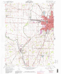
1961 Map of Marion West
USGS Topo · Published 1979About this map
The western edges of Marion and the agricultural lands of Big Island Township define this mid-century landscape. The industrial and civic heart of the city is evident through its concentrated rail infrastructure, including the Erie Lackawanna and Penn Central lines, which converge near the Courthouse and City Hall. Schools like Baker Jr High Sch and Edison Jr High Sch serve the expanding residential neighborhoods of Oak Knoll, while the County Fairground and Marion Country Club provide recreational space on the city's perimeter.
Find a feature on this map
77 named features on this map. Tap any name to fly to it.
Don’t see what you’re looking for? This feature index may not catch every label — zoom into the map to look around manually.
Map Details
Editions of this 1961 Marion West Map
4 editions found
Other maps of this area

1903 · Marion
USGS Topo · 1:62,500

1905 · Marion
USGS Topo · 1:62,500

1913 · Richwood
USGS Topo · 1:62,500

1915 · Richwood
USGS Topo · 1:62,500

1915 · La Rue
USGS Topo · 1:62,500

1924 · Delaware
USGS Topo · 1:62,500

1925 · Delaware
USGS Topo · 1:62,500

1944 · Richwood
USGS Topo · 1:62,500

1944 · Delaware
USGS Topo · 1:62,500

1950 · Marion
USGS Topo · 1:250,000