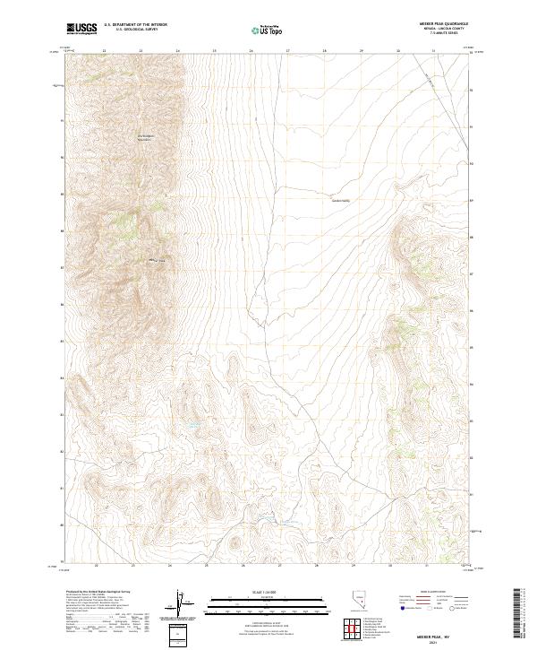
2021 Map of Meeker Peak
USGS Topo · Published 2021About this map
The high ridges of Meeker Peak and the Worthington Mountains dominate this high-desert landscape in Lincoln County. This portion of the Great Basin is characterized by the broad expanse of Garden Valley, which transitions into steep, well-defined mountain ranges. While the terrain is predominantly open and arid, water sources such as Stink-Bug Spring, Rhodes Spring, and Modes Spring provide critical points of interest in an otherwise dry environment. The presence of Mail Summit Rd in the northeastern corner suggests the historical movement of goods and information through these mountain passes. This survey highlights the classic basin-and-range topography, where isolated peaks rise sharply from flat valley floors, creating a distinctive pattern of land use focused on accessible springs and traditional transit corridors.
Find a feature on this map
12 named features on this map. Tap any name to fly to it.
Don’t see what you’re looking for? This feature index may not catch every label — zoom into the map to look around manually.
Map Details
Editions of this 2021 Meeker Peak Map
This is the sole edition of this map. No revisions or reprints were ever made.
Other maps of this area

1942 · Penoyer Valley
USGS Topo · 1:125,000

1954 · Caliente
USGS Topo · 1:250,000

1959 · Caliente
USGS Topo · 1:250,000

1964 · Tempiute Mtn
USGS Topo · 1:62,500

1985 · Worthington Peak
USGS Topo · 1:24,000

1985 · McCutchen Spring
USGS Topo · 1:24,000
1985 · Mount Irish
USGS Topo · 1:24,000

1985 · Murphy Gap
USGS Topo · 1:24,000

1985 · Worthington Peak SW
USGS Topo · 1:24,000

1985 · Murphy Gap NW
USGS Topo · 1:24,000