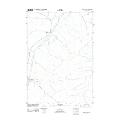
2012 Map of Meeteetse East
USGS Topo · Published 2012About this map
Meeteetse sits at the western edge of this landscape, where the Greybull River and Meeteetse Cr converge. The topography here is defined by wide drainage basins and a series of rural road networks that connect isolated valley points. To the north and east, the land opens into the broad expanse of Long Hollow, framed by the winding courses of Cottonwood Cr and Fifteenmile Cr. The road system, including named routes like Coach Rd and Sleeper Rd, illustrates the navigational patterns across the Park County basin. Local landmarks like Phelps Way and Irish Rock Dr indicate the residential and ranching expansion near the town center as it appeared in the early 21st century.
Find a feature on this map
17 named features on this map. Tap any name to fly to it.
Don’t see what you’re looking for? This feature index may not catch every label — zoom into the map to look around manually.
Map Details
Editions of this 2012 Meeteetse East Map
This is the sole edition of this map. No revisions or reprints were ever made.
Other maps of this area

1911 · Meeteetse
USGS Topo · 1:62,500

1911 · Oregon Basin
USGS Topo · 1:62,500

1913 · Oregon Basin
USGS Topo · 1:62,500

1913 · Meeteetse
USGS Topo · 1:62,500

1951 · Hillberry Rim
USGS Topo · 1:24,000

1951 · Sheets Flat
USGS Topo · 1:24,000

1951 · Wilson Spring
USGS Topo · 1:24,000

1955 · Cody
USGS Topo · 1:250,000

1958 · Cody
USGS Topo · 1:250,000

1962 · Cody
USGS Topo · 1:250,000