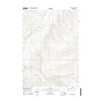
2015 Map of Meeteetse East
USGS Topo · Published 2015About this map
Meeteetse sits at the confluence of several vital water sources, serving as a focal point for the settlement and transport networks of this Big Horn Basin landscape. The Greybull River bisects the terrain, joined by tributaries including Meeteetse Cr and Spring Cr. The street grid of the town site is detailed with specific residential and connector routes such as Irish Rock Dr and Absaroka View Dr, showing the modern expansion of this ranching and livestock center.
Find a feature on this map
28 named features on this map. Tap any name to fly to it.
Don’t see what you’re looking for? This feature index may not catch every label — zoom into the map to look around manually.
Map Details
Editions of this 2015 Meeteetse East Map
This is the sole edition of this map. No revisions or reprints were ever made.
Other maps of this area

1911 · Meeteetse
USGS Topo · 1:62,500

1911 · Oregon Basin
USGS Topo · 1:62,500

1913 · Oregon Basin
USGS Topo · 1:62,500

1913 · Meeteetse
USGS Topo · 1:62,500

1951 · Hillberry Rim
USGS Topo · 1:24,000

1951 · Sheets Flat
USGS Topo · 1:24,000

1951 · Wilson Spring
USGS Topo · 1:24,000

1955 · Cody
USGS Topo · 1:250,000

1958 · Cody
USGS Topo · 1:250,000

1962 · Cody
USGS Topo · 1:250,000