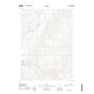
2017 Map of Meeteetse East
USGS Topo · Published 2017About this map
Meeteetse sits at the western edge of this landscape where the Greybull River flows through the high plains of Park County. The settlement pattern here is defined by ranching access and topographic depressions, with long-established routes like the Burlington Meeteeetse Rd and Sleeper Rd connecting the scattered homesteads. The terrain transitions from the wide drainage of Long Hollow in the north to the curiously named Hole in the Ground further south. Local genealogy and history are anchored at the Meeteetse Cem, located just east of the main town site. Several seasonal and perennial waterways, including Cottonwood Cr, Meeteetse Cr, and Fifteenmile Cr, carve through the township and range lines, illustrating the vital role of water rights and drainage in this arid Wyoming environment.
Find a feature on this map
27 named features on this map. Tap any name to fly to it.
Don’t see what you’re looking for? This feature index may not catch every label — zoom into the map to look around manually.
Map Details
Editions of this 2017 Meeteetse East Map
This is the sole edition of this map. No revisions or reprints were ever made.
Other maps of this area

1911 · Meeteetse
USGS Topo · 1:62,500

1911 · Oregon Basin
USGS Topo · 1:62,500

1913 · Oregon Basin
USGS Topo · 1:62,500

1913 · Meeteetse
USGS Topo · 1:62,500

1951 · Hillberry Rim
USGS Topo · 1:24,000

1951 · Sheets Flat
USGS Topo · 1:24,000

1951 · Wilson Spring
USGS Topo · 1:24,000

1955 · Cody
USGS Topo · 1:250,000

1958 · Cody
USGS Topo · 1:250,000

1962 · Cody
USGS Topo · 1:250,000