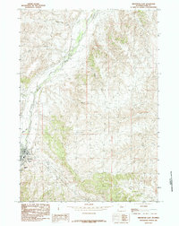
1985 Map of Meeteetse East
USGS Topo · Published 1985About this map
Meeteetse serves as the focal point for this mid-1980s topographical study of the eastern Big Horn Basin. The landscape is defined by the sweeping course of the Greybull River, which is flanked by intricate drainage systems and agricultural infrastructure like the various Ditch segments. This area shows a transition from the river valley to higher ground, marked by distinctive features such as Cemetery Hill and the unique formation known as Needles Eye.
Find a feature on this map
19 named features on this map. Tap any name to fly to it.
Don’t see what you’re looking for? This feature index may not catch every label — zoom into the map to look around manually.
Map Details
Editions of this 1985 Meeteetse East Map
This is the sole edition of this map. No revisions or reprints were ever made.
Other maps of this area

1911 · Meeteetse
USGS Topo · 1:62,500

1911 · Oregon Basin
USGS Topo · 1:62,500

1913 · Oregon Basin
USGS Topo · 1:62,500

1913 · Meeteetse
USGS Topo · 1:62,500

1951 · Hillberry Rim
USGS Topo · 1:24,000

1951 · Sheets Flat
USGS Topo · 1:24,000

1951 · Wilson Spring
USGS Topo · 1:24,000

1955 · Cody
USGS Topo · 1:250,000

1958 · Cody
USGS Topo · 1:250,000

1962 · Cody
USGS Topo · 1:250,000