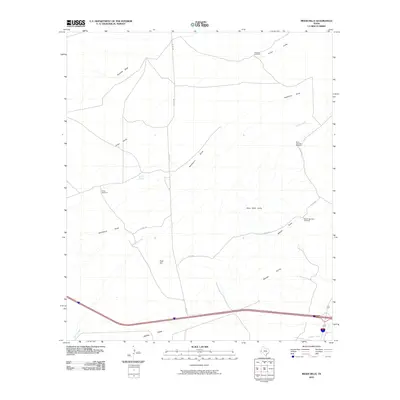
2010 Map of Meier Hills
USGS Topo · Published 2010About this map
Cowan Springs and a series of livestock-supporting windmills define the working landscape of this Reeves County rangeland. The terrain is shaped by the prominence of the Meier Hills and New Well Hills, where the drainage patterns of Hackberry Draw and Adobe Draw converge toward the southeast. Land use in this arid portion of West Texas is marked by isolated landmarks like the Florenzo Windmill and Bravo Windmill, which reflect the essential infrastructure required for ranching. Transportation is anchored by the presence of Co RD 328, providing one of the few managed routes through the drainage systems of Fivemile Draw and Cherry Creek. This map documents a transitional period in the early 21st century where traditional water sources like North New Well Windmill remain critical features of the topographical survey.
Find a feature on this map
15 named features on this map. Tap any name to fly to it.
Don’t see what you’re looking for? This feature index may not catch every label — zoom into the map to look around manually.
Map Details
Editions of this 2010 Meier Hills Map
This is the sole edition of this map. No revisions or reprints were ever made.
Other maps of this area

1894 · Fort Davis
USGS Topo · 1:125,000

1897 · Fort Davis
USGS Topo · 1:125,000

1921 · Toyah
USGS Topo · 1:125,000

1954 · Pecos
USGS Topo · 1:250,000

1954 · Fort Stockton
USGS Topo · 1:250,000

1955 · Saragosa
USGS Topo · 1:62,500

1957 · Pecos
USGS Topo · 1:250,000

1958 · Fort Stockton
USGS Topo · 1:250,000

1970 · Florenzo Hill
USGS Topo · 1:24,000
1970 · Gozar
USGS Topo · 1:24,000