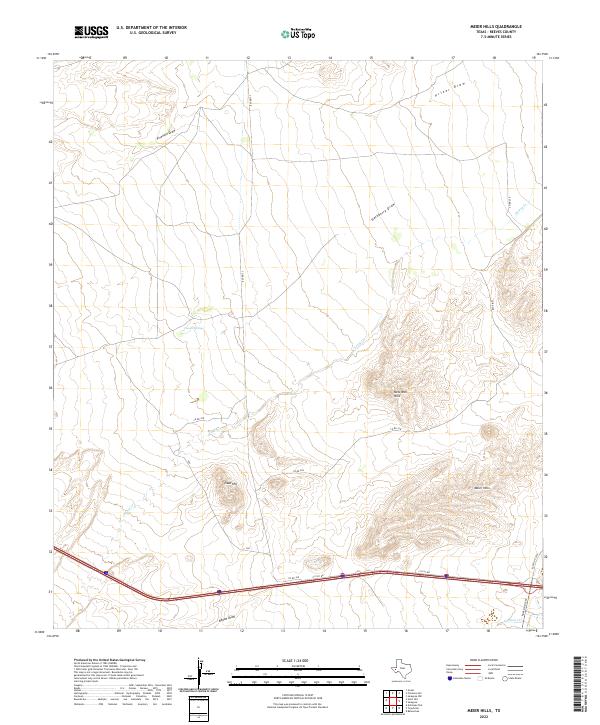
2022 Map of Meier Hills
USGS Topo · Published 2022About this map
Meier Hills and the surrounding high desert terrain dominate this West Texas landscape, where seasonal drainage patterns define the geography. The map reveals an intricate network of dry washes and canyons, including the extensive Fivemile Draw, Hackberry Draw, and Prizer Draw, which carve through the arid plains toward the southern reaches of the Pecos River basin. These topographic features illustrate the harsh hydrological reality of the region, where water only moves during significant storm events.
Find a feature on this map
13 named features on this map. Tap any name to fly to it.
Don’t see what you’re looking for? This feature index may not catch every label — zoom into the map to look around manually.
Map Details
Editions of this 2022 Meier Hills Map
This is the sole edition of this map. No revisions or reprints were ever made.
Other maps of this area

1894 · Fort Davis
USGS Topo · 1:125,000

1897 · Fort Davis
USGS Topo · 1:125,000

1921 · Toyah
USGS Topo · 1:125,000

1954 · Pecos
USGS Topo · 1:250,000

1954 · Fort Stockton
USGS Topo · 1:250,000

1955 · Saragosa
USGS Topo · 1:62,500

1957 · Pecos
USGS Topo · 1:250,000

1958 · Fort Stockton
USGS Topo · 1:250,000

1970 · Florenzo Hill
USGS Topo · 1:24,000
1970 · Gozar
USGS Topo · 1:24,000