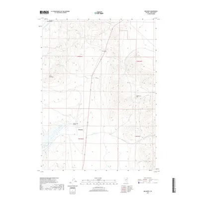
2018 Map of Melandco
USGS Topo · Published 2018About this map
Melandco serves as a central reference point in this corner of Elko County, where the desert landscape transitions through the Windermere Hills. The topography is defined by the drainage of Thousand Springs Cr and the deep incision of Bishop Creek Canyon. This 2018 survey reveals a network of high-desert water sources essential to the region's history, including Ledge Spring and Bishop Spring, which likely supported early ranching or travel through the basin and range province. High points such as H D Summit and the Summer Camp Ridge dominate the horizon, while Sewell Rd provides the primary transit route through this arid terrain. The map meticulously documents the hydrological patterns of Willow Cr, Johnson Cr, and Cricket Cr, providing a clear view of how water dictates the utility and character of this northeastern Nevada territory.
Find a feature on this map
18 named features on this map. Tap any name to fly to it.
Don’t see what you’re looking for? This feature index may not catch every label — zoom into the map to look around manually.
Map Details
Editions of this 2018 Melandco Map
This is the sole edition of this map. No revisions or reprints were ever made.
Other maps of this area

1955 · Wells
USGS Topo · 1:250,000

1958 · Wells
USGS Topo · 1:250,000

1961 · Wells
USGS Topo · 1:250,000

1968 · Wilkins
USGS Topo · 1:24,000

1968 · Holborn
USGS Topo · 1:24,000

1968 · Melandco
USGS Topo · 1:24,000

1968 · Wells Peak
USGS Topo · 1:24,000

1968 · Summer Camp
USGS Topo · 1:24,000
1968 · Oxley Peak
USGS Topo · 1:24,000

1968 · Wine Cup Ranch
USGS Topo · 1:24,000