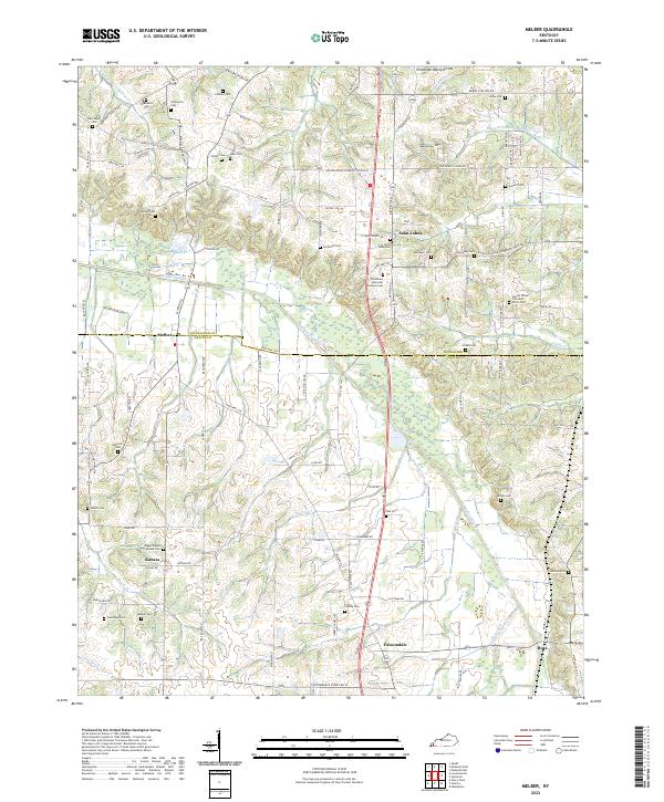
2022 Map of Melber
USGS Topo · Published 2022About this map
Melber and Folsomdale anchor this landscape along the border of McCracken and Graves Counties, where the terrain is defined by the Tennessee-Valley Divide. The area is characterized by a dense network of family-named landmarks and rural cemeteries, such as the Diggs Chapel - Kansas Cem near the small settlement of Kansas and the Houser Grove Church of Christ Cem to the east. These sites, along with numerous smaller burial grounds like Thompson Cem and Allcock Cem, offer significant detail for genealogical research in this part of Western Kentucky.
Find a feature on this map
105 named features on this map. Tap any name to fly to it.
Don’t see what you’re looking for? This feature index may not catch every label — zoom into the map to look around manually.
Map Details
Editions of this 2022 Melber Map
This is the sole edition of this map. No revisions or reprints were ever made.
Other maps of this area

1926 · Paducah
USGS Topo · 1:62,500

1928 · La Center
USGS Topo · 1:62,500

1929 · Paducah
USGS Topo · 1:62,500

1932 · La Center
USGS Topo · 1:62,500

1936 · Melber
USGS Topo · 1:24,000

1936 · Paducah
USGS Topo · 1:24,000

1936 · Symsonia
USGS Topo · 1:24,000

1936 · Westplains
USGS Topo · 1:24,000

1940 · Paducah
USGS Topo · 1:62,500

1949 · Paducah
USGS Topo · 1:250,000