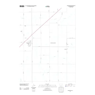
2013 Map of Melbourne
USGS Topo · Published 2013About this map
Melbourne serves as the primary hub of this central Iowa landscape, where a grid of rural roads meets the diagonal path of Highway 330. The town’s layout is clearly defined by local landmarks like Railroad St, College Dr, and Park Ave, reflecting a traditional Midwestern settlement pattern. To the north, the small community of Malta sits near Whites Airport, while the eastern portion of the quadrangle includes State Center Junction and the settlement of Van Cleve. The terrain is drained by several meandering waterways, most notably the N Timber Cr and S Timber Cr, which feed into the N Skunk River at the southern edge. This map documents a well-established agricultural and residential network, capturing the relationship between small-town infrastructure and the surrounding prairie streams like Snipe Cr.
Find a feature on this map
39 named features on this map. Tap any name to fly to it.
Don’t see what you’re looking for? This feature index may not catch every label — zoom into the map to look around manually.
Map Details
Editions of this 2013 Melbourne Map
This is the sole edition of this map. No revisions or reprints were ever made.
Other maps of this area

1954 · Waterloo
USGS Topo · 1:250,000

1954 · Des Moines
USGS Topo · 1:250,000

1955 · Waterloo
USGS Topo · 1:250,000

1956 · Des Moines
USGS Topo · 1:250,000

1957 · Des Moines
USGS Topo · 1:250,000

1960 · Marshalltown
USGS Topo · 1:24,000

1960 · Marshalltown
USGS Topo · 1:62,500

1969 · Des Moines
USGS Topo · 1:250,000

1975 · State Center
USGS Topo · 1:24,000

1975 · Rhodes
USGS Topo · 1:24,000