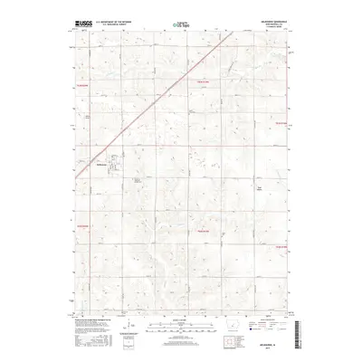
2015 Map of Melbourne
USGS Topo · Published 2015About this map
Melbourne sits at the intersection of local history and modern transit, centered around the diagonal corridor of Marshalltown Blvd and the grid of town streets like Main St and Railroad St. This portion of Marshall County exhibits the classic Iowa section-line road grid, where small rural hubs like Van Cleve are connected by gravel and paved routes such as Lafayette Ave and Co Hwy E67. The landscape is etched by the winding paths of Snipe Cr, N Timber Cr, and S Timber Cr, which disrupt the agricultural geometry. Genealogists will find significant local value in the numerous burial sites documented here, including Maple Grove Cem, Logan Cem, and the Melbourne Memorial Garden Cem. To the northwest, Whites Airport reflects the area's light aviation ties, while the headwaters of the North Skunk River provide a natural boundary in this well-documented corner of the Heartland.
Find a feature on this map
47 named features on this map. Tap any name to fly to it.
Don’t see what you’re looking for? This feature index may not catch every label — zoom into the map to look around manually.
Map Details
Editions of this 2015 Melbourne Map
This is the sole edition of this map. No revisions or reprints were ever made.
Other maps of this area

1954 · Waterloo
USGS Topo · 1:250,000

1954 · Des Moines
USGS Topo · 1:250,000

1955 · Waterloo
USGS Topo · 1:250,000

1956 · Des Moines
USGS Topo · 1:250,000

1957 · Des Moines
USGS Topo · 1:250,000

1960 · Marshalltown
USGS Topo · 1:24,000

1960 · Marshalltown
USGS Topo · 1:62,500

1969 · Des Moines
USGS Topo · 1:250,000

1975 · State Center
USGS Topo · 1:24,000

1975 · Rhodes
USGS Topo · 1:24,000