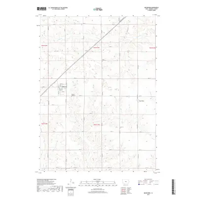
2018 Map of Melbourne
USGS Topo · Published 2018About this map
Melbourne stands at the heart of this central Iowa landscape, where the intersection of Railroad St and Marshalltown Blvd anchors a town plan defined by a structured grid of residential streets like Owen St and 3rd St. The surrounding countryside in Marshall County is dominated by the drainage patterns of the N Skunk River to the southwest and several tributaries, including Snipe Cr and N Timber Cr, which cut through the agricultural sections.
Find a feature on this map
33 named features on this map. Tap any name to fly to it.
Don’t see what you’re looking for? This feature index may not catch every label — zoom into the map to look around manually.
Map Details
Editions of this 2018 Melbourne Map
This is the sole edition of this map. No revisions or reprints were ever made.
Other maps of this area

1954 · Waterloo
USGS Topo · 1:250,000

1954 · Des Moines
USGS Topo · 1:250,000

1955 · Waterloo
USGS Topo · 1:250,000

1956 · Des Moines
USGS Topo · 1:250,000

1957 · Des Moines
USGS Topo · 1:250,000

1960 · Marshalltown
USGS Topo · 1:24,000

1960 · Marshalltown
USGS Topo · 1:62,500

1969 · Des Moines
USGS Topo · 1:250,000

1975 · State Center
USGS Topo · 1:24,000

1975 · Rhodes
USGS Topo · 1:24,000