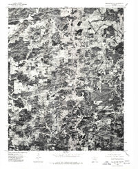
1976 Map of Melbourne NW
USGS Topo · Published 1977About this map
Oxford sits as the central focal point of this 1970s orthophotoquad, which captures the rural landscape of Izard County using aerial imagery from January 1976. This specific type of survey provides a photographic record of land use and timber distribution that standard topographic maps often omit. In the northeastern corner, the Strawberry River winds through the hills, its course clearly visible through the density of riparian vegetation. The map reveals a mosaic of cleared agricultural parcels and dense Ozark woodlands, showing the development of rural roads and homesteads centered around the settlement at Oxford. Because this is an orthophotograph, it preserves the exact visual state of the ground cover and farmstead footprints just before the late 1970s.
Find a feature on this map
2 named features on this map. Tap any name to fly to it.
Don’t see what you’re looking for? This feature index may not catch every label — zoom into the map to look around manually.
Map Details
Editions of this 1976 Melbourne NW Map
This is the sole edition of this map. No revisions or reprints were ever made.
Other maps of this area

1890 · Mountain Home
USGS Topo · 1:125,000

1891 · Mountain Home
USGS Topo · 1:125,000

1894 · Mountain Home
USGS Topo · 1:125,000

1945 · Harrison
USGS Topo · 1:250,000

1949 · Harrison
USGS Topo · 1:250,000

1950 · Salem
USGS Topo · 1:62,500

1951 · Salem
USGS Topo · 1:62,500

1951 · Melbourne
USGS Topo · 1:62,500

1954 · Harrison
USGS Topo · 1:250,000

1957 · Poplar Bluff
USGS Topo · 1:250,000