
1951 Map of Melbourne West
USGS Topo · Published 1951About this map
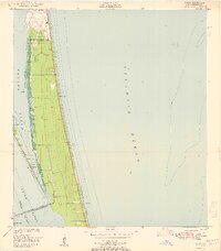
Malabar Naval Air Station anchors the southern portion of this mid-century Florida landscape, showcasing the military footprint in Brevard County just after the war years. The map documents a period of early aviation and transit, with the Melbourne-Eau Gallie Airport and the Florida East Coast railroad serving as vital infrastructure for the emerging communities of Eau Gallie and Melbourne. The western expanse is dominated by the marshy reaches of Lake Washington and the Johns River, where drainage features like a prominent Levee and various Spoil Banks indicate efforts to manage the wetlands. Small inland settlements such as June Park, Mintons Corner, and Sweetwater Camp appear as concentrated developments amidst a complex network of banks and canals. Local social and healthcare history is reflected in the presence of the State Hospital and the Melbourne Golf and Country Club.
Find a feature on this map
17 named features on this map. Tap any name to fly to it.
Don’t see what you’re looking for? This feature index may not catch every label — zoom into the map to look around manually.
Map Details
Editions of this 1951 Melbourne West Map
This is the sole edition of this map. No revisions or reprints were ever made.
Other maps of this area

1949 · Melbourne West
USGS Topo · 1:24,000

1949 · Melbourne East
USGS Topo · 1:24,000

1949 · Eau Gallie
USGS Topo · 1:24,000

1949 · Grant
USGS Topo · 1:24,000

1949 · Tropic
USGS Topo · 1:24,000

1951 · Melbourne East
USGS Topo · 1:24,000

1951 · Eau Gallie
USGS Topo · 1:24,000

1951 · Grant
USGS Topo · 1:24,000
1951 · Tropic
USGS Topo · 1:24,000

1953 · Deer Park NE
USGS Topo · 1:24,000