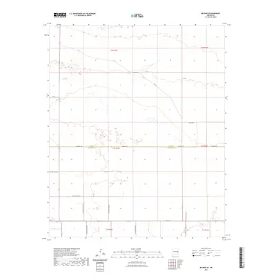
2023 Map of Melrose SE
USGS Topo · Published 2023About this map
The boundary of Curry Co Roosevelt Co bisects this high plains landscape, defining the transition between the agricultural and grazing lands of eastern New Mexico. This 2023 survey illustrates the rigid, rectilinear grid of the Public Land Survey System that organizes the region, with section lines marked by routes such as Sun Dale Valley Rd and Curry Road 4. To the south, the Base Line and Baseline Rd serve as critical geographic anchors for property and township identification. The map reveals a sparse, high-desert environment where infrastructure is primarily focused on supporting rural transit and livestock, with extensive road names like N Roosevelt Road T and Roosevelt Rd tracing the paths of local travel across the expanse.
Find a feature on this map
24 named features on this map. Tap any name to fly to it.
Don’t see what you’re looking for? This feature index may not catch every label — zoom into the map to look around manually.
Map Details
Editions of this 2023 Melrose SE Map
This is the sole edition of this map. No revisions or reprints were ever made.
Other maps of this area

1954 · Clovis
USGS Topo · 1:250,000

1957 · Portair
USGS Topo · 1:62,500

1957 · Melrose
USGS Topo · 1:62,500

1957 · Portales
USGS Topo · 1:62,500

1958 · Clovis
USGS Topo · 1:250,000

1972 · Melrose East
USGS Topo · 1:24,000

1973 · Floyd
USGS Topo · 1:24,000

1973 · Melrose West
USGS Topo · 1:24,000

1973 · Tule Lake
USGS Topo · 1:24,000

1973 · Upton
USGS Topo · 1:24,000