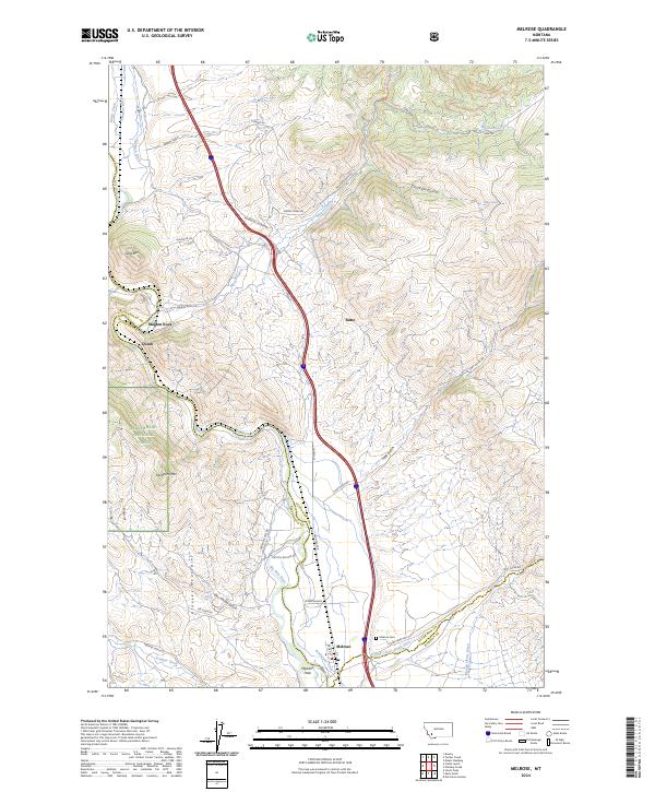
2024 Map of Melrose
USGS Topo · Published 2024About this map
The Big Hole River carves a deep path through this Montana landscape, where the settlements of Melrose and Maiden Rock sit along the narrow valley floor. The area is defined by the high elevations of the Pioneer Mountains, including named peaks like Goat Mtn and Shepherd Mtn. Irrigation infrastructure is prominent throughout the river corridor, evidenced by the Johnson Ditch, Kimbach Ditch, and Pendergast Ditch, which support local agriculture in an otherwise arid, high-altitude environment. Within the village of Melrose, local landmarks such as Melrose Cem and the Maddox Hole river feature provide specific points of interest for genealogists and local historians. Much of the western terrain falls within the Beaverhead National Forest, characterized by steep drainages like Soap Gulch and Chicken Gulch that flow toward the central river valley.
Find a feature on this map
51 named features on this map. Tap any name to fly to it.
Don’t see what you’re looking for? This feature index may not catch every label — zoom into the map to look around manually.
Map Details
Editions of this 2024 Melrose Map
This is the sole edition of this map. No revisions or reprints were ever made.
Other maps of this area

1893 · Dillon
USGS Topo · 1:250,000

1955 · Dillon
USGS Topo · 1:250,000

1957 · Dillon
USGS Topo · 1:250,000

1958 · Dillon
USGS Topo · 1:250,000

1958 · Vipond Park
USGS Topo · 1:62,500

1961 · Melrose
USGS Topo · 1:24,000

1961 · Earls Gulch
USGS Topo · 1:24,000

1961 · Wickiup Creek
USGS Topo · 1:24,000

1961 · Nez Perce Hollow
USGS Topo · 1:24,000

1961 · Butte South
USGS Topo · 1:62,500