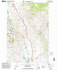
1997 Map of Melrose
USGS Topo · Published 2002About this map
Melrose serves as the focal point of this high-country landscape, situated where the Big Hole River winds through narrow valleys near the borders of Silver Bow, Beaverhead, and Madison counties. The area's industrial legacy is etched into the terrain through numerous prospects and established operations such as the Old Glory Mine and Maiden Rock Mine. Water management is central to the settlement pattern, evidenced by an extensive network of irrigation infrastructure including the Mc Cauley Ditch, Pendergast Ditch, and Smith Camp Ditch, which redirect flow from the river to supporting agricultural and mining needs.
Find a feature on this map
43 named features on this map. Tap any name to fly to it.
Don’t see what you’re looking for? This feature index may not catch every label — zoom into the map to look around manually.
Map Details
Editions of this 1997 Melrose Map
This is the sole edition of this map. No revisions or reprints were ever made.
Other maps of this area

1893 · Dillon
USGS Topo · 1:250,000

1955 · Dillon
USGS Topo · 1:250,000

1957 · Dillon
USGS Topo · 1:250,000

1958 · Dillon
USGS Topo · 1:250,000

1958 · Vipond Park
USGS Topo · 1:62,500

1961 · Melrose
USGS Topo · 1:24,000

1961 · Earls Gulch
USGS Topo · 1:24,000

1961 · Wickiup Creek
USGS Topo · 1:24,000

1961 · Nez Perce Hollow
USGS Topo · 1:24,000

1961 · Butte South
USGS Topo · 1:62,500