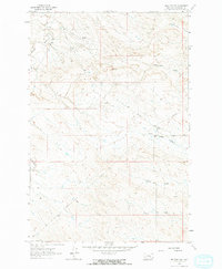
1962 Map of Melstone NW
USGS Topo · Published 1965About this map
The Ragged Point Oil Field dominates this central Montana landscape, revealing an industrial footprint defined by extensive drilling and energy infrastructure in the early 1960s. Numerous Oil Wells and a central Pipeline network crisscross the terrain, supported by a Pumping Sta that indicates the active extraction era. The geography is characterized by a series of deep drainage channels known locally as coulees, including Seventynine Coulee and Keggy Coulee, which carve through the high plains toward larger watercourses.
Find a feature on this map
16 named features on this map. Tap any name to fly to it.
Don’t see what you’re looking for? This feature index may not catch every label — zoom into the map to look around manually.
Map Details
Editions of this 1962 Melstone NW Map
2 editions found
Other maps of this area

1954 · Forsyth
USGS Topo · 1:250,000

1954 · Roundup
USGS Topo · 1:250,000

1957 · Forsyth
USGS Topo · 1:250,000

1958 · Roundup
USGS Topo · 1:250,000

1958 · Forsyth
USGS Topo · 1:250,000

1962 · Queens Point
USGS Topo · 1:24,000

1962 · Melstone NE
USGS Topo · 1:24,000

1962 · Maxwell Ranch
USGS Topo · 1:24,000

1962 · Melstone NW
USGS Topo · 1:24,000

1962 · Mosby SE
USGS Topo · 1:24,000