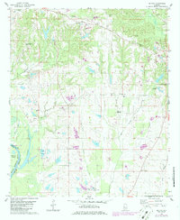
1980 Map of Melton
USGS Topo · Published 1986About this map
The Black Warrior River defines the western edge of this landscape, carving the sharp loop known as Duffys Bend as it borders Lake Demopolis. This 1980s revision reveals a countryside deeply connected to the land and its institutions, from the State Penal Farm and Fish Hatchery in the south to the Lakeview Country Club near the eastern boundary. The map serves as a detailed record of rural social centers, documenting numerous family and community landmarks like St Peters Ch, Mt Mariah Ch, and the Greensboro Municipal Airport. Drainage from Big German Creek and Little German Creek dictates the movement of people and roads through the settlement at Melton, while the riverfront history is anchored by Withers Landing.
Find a feature on this map
39 named features on this map. Tap any name to fly to it.
Don’t see what you’re looking for? This feature index may not catch every label — zoom into the map to look around manually.
Map Details
Editions of this 1980 Melton Map
2 editions found
Other maps of this area

1927 · Eutaw
USGS Topo · 1:48,000

1931 · Eutaw
USGS Topo · 1:62,500

1946 · Demopolis
USGS Topo · 1:24,000

1947 · Demopolis
USGS Topo · 1:24,000

1947 · Mason Bend
USGS Topo · 1:24,000

1948 · Mason Bend
USGS Topo · 1:24,000

1953 · Montgomery
USGS Topo · 1:250,000

1956 · Montgomery
USGS Topo · 1:250,000

1957 · Montgomery
USGS Topo · 1:250,000

1979 · Greensboro
USGS Topo · 1:24,000