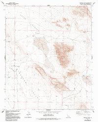
1972 Map of Melville Lake
USGS Topo · Published 1994About this map
Upper Johnson Valley defines this arid landscape, where the ephemeral basins of Melville Lake and Means Lake anchor a region of high desert terrain. Grounded in a 1970 aerial survey, the map details a sparse but deliberate network of human activity in the San Bernardino desert. Early ranching footprints like Shehorn Ranch appear alongside remote infrastructure, including a prominent Landing Strip and specialized water sources like Means Well and Dry Well. The desert's physical character is marked by extensive Sand Dunes and localized industrial activity at a Quarry and various mineral Prospects. Transport throughout the valley relies on a grid of dirt tracks and named routes such as Pony Road and Cole Rd, illustrating the intersection of recreation, ranching, and resource exploration in the early 1970s.
Find a feature on this map
18 named features on this map. Tap any name to fly to it.
Don’t see what you’re looking for? This feature index may not catch every label — zoom into the map to look around manually.
Map Details
Editions of this 1972 Melville Lake Map
3 editions found
Other maps of this area

1901 · Southern California Sheet No. 1
USGS Topo · 1:250,000

1902 · San Gorgonio
USGS Topo · 1:125,000

1904 · Southern California Sheet No. 1
USGS Topo · 1:250,000

1953 · San Bernardino
USGS Topo · 1:250,000

1954 · Galway Lake
USGS Topo · 1:24,000

1954 · Emerson Lake
USGS Topo · 1:24,000

1955 · Old Woman Springs
USGS Topo · 1:62,500

1955 · Lavic
USGS Topo · 1:62,500

1955 · Emerson Lake
USGS Topo · 1:62,500

1955 · Rodman Mountains
USGS Topo · 1:62,500