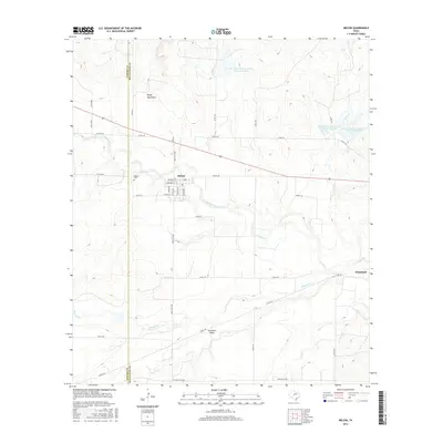
2016 Map of Melvin
USGS Topo · Published 2016About this map
Melvin serves as the primary hub of this McCulloch County landscape, where the town's residential grid—including W Beach St and Hackberry St—is positioned just south of the Brady Mountains. The area's agricultural and ranching character is defined by a dense network of county roads and vital water management features like the Soil Conservation Service Site 39 Reservoir. Moving east toward Whiteland, the terrain is carved by the winding course of Brady Creek and its many tributaries, including S Brady Cr and Cow Cr. These waterways, along with features such as Clements Draw, illustrate the complex drainage patterns essential to West Texas ranching. Genealogists may find interest in the location of the Melvin Cem, situated along the western edge of the settlement near the Concho Co line.
Find a feature on this map
44 named features on this map. Tap any name to fly to it.
Don’t see what you’re looking for? This feature index may not catch every label — zoom into the map to look around manually.
Map Details
Editions of this 2016 Melvin Map
This is the sole edition of this map. No revisions or reprints were ever made.
Other maps of this area

1892 · Eden
USGS Topo · 1:125,000

1894 · Brady
USGS Topo · 1:125,000

1896 · Eden
USGS Topo · 1:125,000

1928 · Waldrip
USGS Topo · 1:62,500

1931 · Stacy
USGS Topo · 1:62,500

1954 · Brownwood
USGS Topo · 1:250,000

1960 · West Sweden
USGS Topo · 1:24,000

1960 · Melvin
USGS Topo · 1:24,000

1963 · Brady SW
USGS Topo · 1:24,000
1967 · Salt Gap
USGS Topo · 1:24,000