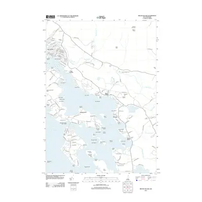
2012 Map of Melvin Village
USGS Topo · Published 2012About this map
Melvin Village and its surrounding coves define this coastal-like reach of the northeastern Lake Winnipesaukee shoreline. The landscape transitions quickly from the lake's many islands, such as Long Island and Nineacre Island, to the rising slopes of Ossipee Mountain and Mount Shaw. The era's transportation network is particularly varied, featuring the Melvin Village Airport, the Loons Nest Seaplane Base, and the Union Wharf at the mouth of the Melvin River. This 2012 survey documents a sophisticated recreation-based economy, evidenced by the dense residential road networks of State Landing and the prominence of Moultonborough Town Beach. Inland, quiet markers of local history persist in the form of the Bodge Cem and Town Hall Cem, while Shannon Brook and Twentymile Brook drain the wooded uplands into the lake's basin.
Find a feature on this map
159 named features on this map. Tap any name to fly to it.
Don’t see what you’re looking for? This feature index may not catch every label — zoom into the map to look around manually.
Map Details
Editions of this 2012 Melvin Village Map
This is the sole edition of this map. No revisions or reprints were ever made.
Other maps of this area

1909 · Winnepesaukee
USGS Topo · 1:62,500

1928 · Wolfeboro
USGS Topo · 1:62,500

1930 · Ossipee Lake
USGS Topo · 1:62,500

1931 · Mt. Chocorua
USGS Topo · 1:62,500

1949 · Portland
USGS Topo · 1:250,000

1956 · Winnipesaukee
USGS Topo · 1:62,500

1956 · Portland
USGS Topo · 1:250,000

1958 · Ossipee Lake
USGS Topo · 1:62,500

1958 · Wolfeboro
USGS Topo · 1:62,500

1958 · Mt. Chocorua
USGS Topo · 1:62,500