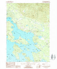
1987 Map of Melvin Village
USGS Topo · Published 1987About this map
The northeastern reaches of Lake Winnipesaukee dominate this mid-1980s topographical study, where the waters of Moultonborough Bay meet the rising slopes of the Ossipee Mountains. The settlement pattern follows the intricate shoreline, anchored by Melvin Village and the historic landing at Union Wharf. Notable island geography is well-documented, from the large expanse of Long Island to smaller outcrops like Whortleberry Island and Spectacle Island.
Find a feature on this map
66 named features on this map. Tap any name to fly to it.
Don’t see what you’re looking for? This feature index may not catch every label — zoom into the map to look around manually.
Map Details
Editions of this 1987 Melvin Village Map
This is the sole edition of this map. No revisions or reprints were ever made.
Other maps of this area

1909 · Winnepesaukee
USGS Topo · 1:62,500

1928 · Wolfeboro
USGS Topo · 1:62,500

1930 · Ossipee Lake
USGS Topo · 1:62,500

1931 · Mt. Chocorua
USGS Topo · 1:62,500

1949 · Portland
USGS Topo · 1:250,000

1956 · Winnipesaukee
USGS Topo · 1:62,500

1956 · Portland
USGS Topo · 1:250,000

1958 · Ossipee Lake
USGS Topo · 1:62,500

1958 · Wolfeboro
USGS Topo · 1:62,500

1958 · Mt. Chocorua
USGS Topo · 1:62,500