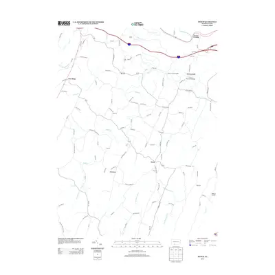
2013 Map of Mench
USGS Topo · Published 2013About this map
Jackson Mills and the historic Jackson's Mill Covered Bridge anchor the northeastern landscape of this region, where the Raystown Br Juniata River flows through the valleys of Bedford County. The terrain is defined by prominent ridges like Rays Hill and the deep drainage of Wildcat Hollow, with the headwaters of W Br Sideling Hill Cr and E Br Sideling Hill Cr carving the southern slopes. This survey illustrates a network of rural hamlets including Mattie, Emerson, and Mench, connected by long-established routes such as Menchtown Rd. The presence of multiple historic crossings, such as Felten's Covered Bridge over Brush Cr, reflects a landscape where transport was dictated by the winding watercourses and steep gaps. In the north, Juniata Crossing marks an essential point on the river, situated near the modern thoroughfare of Interstate 70/76.
Find a feature on this map
98 named features on this map. Tap any name to fly to it.
Don’t see what you’re looking for? This feature index may not catch every label — zoom into the map to look around manually.
Map Details
Editions of this 2013 Mench Map
This is the sole edition of this map. No revisions or reprints were ever made.
Other maps of this area

1900 · Everett
USGS Topo · 1:62,500

1902 · Everett
USGS Topo · 1:62,500

1925 · Needmore
USGS Topo · 1:48,000

1927 · Clearville
USGS Topo · 1:48,000

1930 · Broad Top
USGS Topo · 1:62,500

1931 · Clearville
USGS Topo · 1:62,500

1933 · Broad Top
USGS Topo · 1:62,500

1935 · Needmore
USGS Topo · 1:62,500

1939 · Needmore
USGS Topo · 1:62,500

1944 · Clearville
USGS Topo · 1:62,500
Featured Places
- East Providence Township, PA
- Jackson Mills, East Providence Township
- Juniata Crossing, East Providence Township
- Emerson, Monroe Township
- Mench, West Providence Township