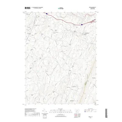
2019 Map of Mench
USGS Topo · Published 2019About this map
Brush Creek and its various tributaries carve through a series of long, parallel ridges in this part of Bedford and Fulton Counties, creating a landscape of isolated farming valleys and wooded uplands. Small rural settlements like Mench, Mattie, and Jackson Mills are concentrated in these corridors, where historic transportation links are preserved through structures like Jackson's Mill Covered Bridge and Felten's Covered Bridge. The map reveals a dense network of family history markers, with numerous small burial sites such as the Dibert Farm Cem, Sparks Family Cem, and Calhoun Farm Cem scattered across the ridges. This pattern of land use indicates a long-standing tradition of multi-generational family farming. While the topography is dominated by features like Addison Ridge and Rays Hill, the inclusion of the Greater Breezewood Regional Airport in the south provides a contemporary contrast to the surrounding traditional homesteads and country churches.
Find a feature on this map
102 named features on this map. Tap any name to fly to it.
Don’t see what you’re looking for? This feature index may not catch every label — zoom into the map to look around manually.
Map Details
Editions of this 2019 Mench Map
This is the sole edition of this map. No revisions or reprints were ever made.
Other maps of this area

1900 · Everett
USGS Topo · 1:62,500

1902 · Everett
USGS Topo · 1:62,500

1925 · Needmore
USGS Topo · 1:48,000

1927 · Clearville
USGS Topo · 1:48,000

1930 · Broad Top
USGS Topo · 1:62,500

1931 · Clearville
USGS Topo · 1:62,500

1933 · Broad Top
USGS Topo · 1:62,500

1935 · Needmore
USGS Topo · 1:62,500

1939 · Needmore
USGS Topo · 1:62,500

1944 · Clearville
USGS Topo · 1:62,500
Featured Places
- East Providence Township, PA
- Jackson Mills, East Providence Township
- Juniata Crossing, East Providence Township
- Emerson, Monroe Township
- Mench, West Providence Township