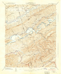
1939 Map of Mendota
USGS Topo · Published 1939About this map
Mendota and the surrounding river valleys of Washington, Russell, and Scott Counties are documented here just before the close of the 1930s. The landscape is defined by the North Fork Holston River, which is crossed by numerous river crossings including McFadden Ford and Hobbs Ford. This era shows a community deeply tied to its geography, with the Southern railroad line and a local Aerial Tramway near Silica indicating the transport of timber or minerals from the ridges.
Find a feature on this map
102 named features on this map. Tap any name to fly to it.
Don’t see what you’re looking for? This feature index may not catch every label — zoom into the map to look around manually.
Map Details
Editions of this 1939 Mendota Map
This is the sole edition of this map. No revisions or reprints were ever made.
Other maps of this area

1897 · Bristol
USGS Topo · 1:125,000

1902 · Bristol
USGS Topo · 1:125,000

1918 · Carterton
USGS Topo · 1:62,500

1920 · Coeburn
USGS Topo · 1:48,000

1934 · Wallace
USGS Topo · 1:24,000

1934 · Hansonville
USGS Topo · 1:24,000

1934 · Bristol
USGS Topo · 1:24,000

1935 · Hilton
USGS Topo · 1:24,000

1935 · Mendota
USGS Topo · 1:24,000

1935 · Blountville
USGS Topo · 1:24,000